


Zonensuche & POIs
There is no translation available. POIs (Points of Interest) sind benannte Orte mit geografischer Zuordnung. Sie können zum Beispiel POIs für Ihre Kunden anlegen und diese für Ihre Tourenplanung ve...

Remaining driving time
To avoid exploitation and overburdening of drivers, various regulations are anchored in driver labor laws. BlueLOGICO® assists you in always considering the regulations and laws during route planni...

Track & Trace
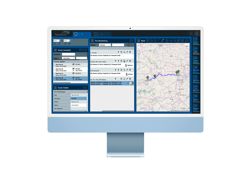
Where are my vehicles? Are the prescribed routes being followed? TachoEASY provides answers to these and many other questions with the Track & Trace feature. Using top-o...
Digital document management
Digital documents and forms reduce paper consumption, simplify order management, and streamline the documentation of organizational tasks such as pre-departure checks. In BlueLOGICO®, PDF documents...